Introduction
Can a satellite orbiting hundreds of kilometers above Earth help predict the next disease outbreak? Increasingly, scientists believe the answer is yes. The growing field of Satellite Disease Forecasting combines Earth-observing technologies with epidemiology, climate science, and artificial intelligence to identify environmental conditions that may increase disease risk before outbreaks occur.
While satellites have long been associated with weather forecasting and environmental monitoring, their role in public health is rapidly expanding. Modern satellite systems can track rainfall patterns, vegetation growth, surface temperatures, flooding, drought conditions, air quality, and land-use changes across entire continents. These environmental signals often influence the spread of infectious diseases, particularly those transmitted by mosquitoes, ticks, and other vectors.As climate change, urbanization, and ecosystem disruption reshape disease patterns worldwide, researchers are increasingly looking to space for answers.
Can Satellite Disease Forecasting provide the early warnings needed to prevent future outbreaks?
Satellite Disease Forecasting and Vector-Borne Diseases
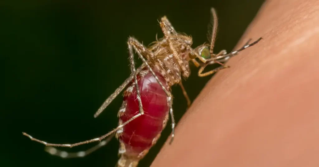
Many infectious diseases depend heavily on environmental conditions. Mosquitoes carrying malaria, dengue, chikungunya, and West Nile virus require specific combinations of temperature, moisture, and habitat availability to thrive.
Satellites can monitor these conditions continuously across large geographic areas. By analyzing rainfall, vegetation density, and surface temperatures, researchers can identify regions where vector populations are likely to increase [1].
Recent studies have shown that satellite-derived environmental data can improve forecasting models for vector-borne diseases, allowing health agencies to prepare interventions before outbreaks intensify.
Climate Signals and Emerging Disease Risks
One of the most important applications of remote sensing involves tracking climate patterns that influence disease transmission.
Large-scale climate events such as El Niño can alter rainfall and temperature conditions across multiple continents. Research has demonstrated that these environmental shifts are often associated with increases in diseases such as Rift Valley fever, cholera, dengue, and malaria [2].
Today, scientists are increasingly combining satellite observations with machine learning tools to identify climate-driven health risks months before they become visible through traditional surveillance systems.
This represents a major shift from reactive outbreak response toward predictive public health planning.
What Satellites Reveal About Human Activity
Disease risk is not influenced by climate alone. Human activities such as deforestation, urban expansion, agricultural development, and habitat fragmentation can also affect disease emergence.
Earth-observing satellites allow researchers to monitor these landscape changes in near real time. Studies have shown that land-use change can alter wildlife habitats, increase contact between humans and animals, and create conditions that facilitate the emergence of zoonotic diseases [3].
These observations provide valuable insights into how environmental change influences public health at local and global scales.
Air Quality, Heat, and Public Health
Modern satellite systems are also helping scientists monitor environmental health risks beyond infectious diseases.
Satellite-based sensors can track air pollution, wildfire smoke, heatwaves, and atmospheric conditions that affect respiratory and cardiovascular health. Research indicates that exposure to fine particulate matter contributes to millions of premature deaths worldwide each year [4].
By providing broad geographic coverage, satellites help identify vulnerable populations and support early warning systems for environmental health emergencies.
A One Health Perspective
The concept of Satellite Disease Forecasting aligns closely with the One Health approach because it recognizes that human health is deeply connected to environmental and animal health systems.
Many disease outbreaks emerge from interactions between climate conditions, ecosystems, wildlife populations, and human activities. Satellite technologies provide a unique opportunity to observe these interconnected factors simultaneously.
When combined with veterinary surveillance, public health reporting, and environmental monitoring, satellite data can help researchers better understand where and why disease risks are changing.
This integrated perspective strengthens preparedness and supports more effective prevention strategies.
Conclusion
The future of disease prevention may depend on information collected far above Earth’s surface. The expanding field of Satellite Disease Forecasting is helping scientists identify environmental conditions that influence disease transmission, monitor emerging health threats, and improve outbreak preparedness.
From tracking mosquito habitats and climate anomalies to monitoring air pollution and land-use change, satellites are providing insights that were unimaginable only a few decades ago.
The next major breakthrough in disease prevention might not come from a laboratory—it could come from orbit.
References
- Thomson, M.C. et al., 2006. Malaria early warnings based on seasonal climate forecasts from multi-model ensembles. Nature, 439, pp.576–579. https://doi.org/10.1038/nature04503
- Anyamba, A. et al., 2019. Global disease outbreaks associated with the 2015–2016 El Niño event. Scientific Reports, 9, Article 1930.
https://doi.org/10.1038/s41598-018-38034-z - Carlson, C.J. et al., 2022. The future of zoonotic risk prediction. Philosophical Transactions of the Royal Society B, 377(1857), 20210256.
https://doi.org/10.1098/rstb.2021.0256 - van Donkelaar, A. et al., 2021. Global estimates of fine particulate matter using a combined geophysical-statistical method with information from satellites, models, and monitors. Environmental Science & Technology, 55(11), pp.7168–7179.
https://doi.org/10.1021/acs.est.0c01764