Introduction
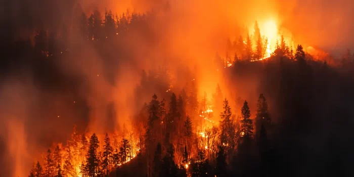
Wildfires and Environmental Impact are closely linked, with fires causing significant changes to hydrological systems and increasing the risks of flooding and landslides. When wildfires destroy vegetation, the loss of root systems leads to soil instability, increased runoff, and higher susceptibility to natural disasters. This article explores how wildfires contribute to these risks, presenting global case studies and mitigation strategies to address post-fire environmental hazards.
You're viewing a members-only article.
To keep reading, please log in or join the One Health Society.
Stay connected to exclusive insights, expert commentary, and opportunities to collaborate across the fields of human, animal, and environmental health.
Already a member? Log In
New here? Join the One Health Society - become One
Hydrological Changes Post-Wildfire
Wildfires alter natural water retention and soil stability, leading to serious consequences:
- Increased Surface Runoff: Without plant roots to absorb water, precipitation moves rapidly, leading to flash floods.
- Hydrophobic Soils: High heat creates water-repellent soil layers, preventing water absorption and exacerbating flood risks.
- Loss of Soil Stability: The absence of root structures destabilizes slopes, increasing the likelihood of landslides.
These hydrological shifts persist long after the fire is extinguished, making post-wildfire areas highly vulnerable to environmental hazards.
Soil Erosion and Landslide Susceptibility
Wildfire-induced vegetation loss results in:
- Sediment Deposition in Waterways: Excess sediment reduces water quality and disrupts aquatic ecosystems.
- Slope Instability: Without plant roots to hold soil, hillsides become prone to landslides. [6]
- Debris Flows: Post-fire rainfall triggers rapid movements of mud, rocks, and vegetation, threatening infrastructure and communities.
Global Case Studies
1. United States: The California Camp Fire (2018)
The Camp Fire, one of the deadliest in U.S. history, burned over 153,000 acres, leading to:
- Flash Floods: Heavy post-fire rainfall caused widespread flooding. [4]
- Mudslides: Unstable slopes led to destructive landslides. [4]
- Hydrophobic Soil Effects: Studies from the U.S. Geological Survey (USGS) reported a 70% increase in runoff due to fire-induced soil repellency. [1]
2. Canada: British Columbia Wildfires
Severe wildfires in British Columbia have led to:
- Increased Flood Risks: The loss of trees and vegetation reduces the land’s ability to absorb rainfall, leading to excessive surface runoff. [6]
- Erosion and Landslides: The removal of vegetation exposes soil to the elements, increasing erosion and landslide risks in mountainous regions. [6]
- Sedimentation in Water Sources: Elevated erosion rates lead to increased sediment in waterways, degrading water quality and impacting aquatic ecosystems. [7]
3. Australia: Black Summer Fires (2019–2020)
Mitigation Strategies
Reforestation and Vegetative Restoration
- Planting Fast-Growing Vegetation: Helps stabilize soil and reduce runoff. For example, in California, native species like willows and poplars have been successfully used in post-fire restoration projects to stabilize burned landscapes.
- Erosion Control Measures: Mulching and contour trenching prevent soil loss. In Australia, straw mulching has been applied to fire-affected areas to protect topsoil and encourage vegetation regrowth, reducing runoff and sediment transport.
Improved Land Management Practices
- Creating Defensible Spaces: Prevents uncontrolled fire spread. In the United States, communities in wildfire-prone areas follow “Firewise” guidelines, which involve clearing brush and maintaining a safe perimeter around structures to reduce fire damage.
- Prescribed Burns: Reduces excessive fuel loads, lowering wildfire intensity. For example, Indigenous fire management practices in Australia use controlled burning techniques to maintain landscape balance, minimizing the risk of catastrophic wildfires.
Infrastructure Adaptations
- Creating Defensible Spaces: Prevents uncontrolled fire spread. In the United States, communities in wildfire-prone areas follow “Firewise” guidelines, which involve clearing brush and maintaining a safe perimeter around structures to reduce fire damage.
- Prescribed Burns: Reduces excessive fuel loads, lowering wildfire intensity. For example, Indigenous fire management practices in Australia use controlled burning techniques to maintain landscape balance, minimizing the risk of catastrophic wildfires.
Early Warning Systems
- Real-Time Monitoring: Detects soil movement and potential flooding risks. In California, geospatial technologies and remote sensing are used to track soil displacement and predict potential landslides in post-fire areas.
- Community Education: Ensures preparedness through evacuation planning and hazard awareness. In wildfire-prone regions, public awareness campaigns and emergency drills help residents understand evacuation routes and safety measures to reduce wildfire-related casualties and damage.
Conclusion
The link between wildfires and environmental impact is undeniable, with post-fire landscapes facing heightened risks of flooding and landslides. As climate change continues to intensify wildfire seasons globally, it is crucial to implement effective mitigation strategies. Through reforestation, improved land management, and infrastructure adaptations, we can enhance resilience and protect both ecosystems and human settlements.
References
- U.S. Geological Survey (USGS). (2025). Post-Wildfire Hydrology and Flood Risks. Available at: https://www.usgs.gov/ [Accessed 5 Feb. 2025].
- Nature Journal. (2025). Impact of Wildfires on British Columbia’s Hydrology. Available at: https://www.nature.com/ [Accessed 5 Feb. 2025].
- Australian Bureau of Meteorology. (2025). Climate and Hydrological Effects of 2019–2020 Bushfires. Available at: https://www.bom.gov.au/ [Accessed 5 Feb. 2025].
- AGU Publications. (2020). Environmental effects of Australia’s 2019–2020 wildfires. Available at: https://agupubs.onlinelibrary.wiley.com/doi/pdf/10.1029/2020EF001884 [Accessed 5 Feb. 2025].
- Government of British Columbia. (2025). Landslide and Flooding Risks Due to Wildfires. Available at: https://www2.gov.bc.ca/assets/gov/farming-natural-resources-and-industry/natural-resource-use/resource-roads/local-road-safety-information/landslide_flooding_risks_due_to_wildfires-sign.pdf [Accessed 5 Feb. 2025].
- IAHS. (2025). Wildfire-Induced Landslides and Erosion Risks. Available at: https://iahs.info/wildfire-landslides [Accessed 5 Feb. 2025].
- ScienceDirect. (2025). Post-Fire Sediment Transport and Water Quality. Available at: https://sciencedirect.com/postfire-sediment [Accessed 5 Feb. 2025].
- AGU. (2025). Severe Flooding Following the Black Summer Fires. Available at: https://agu.org/black-summer-flooding [Accessed 5 Feb. 2025].


